
Riding the back road to Gympie is an alternative to the busy highway for riders heading to central and north Queensland. It takes longer but, it’s well worth the time and extra miles. One would think it is tailor-made for an adventure rider looking for sweeping rural hills and quaint rustic villages. If you have read my blog posts on Café Racing-Queensland Style, you will know that I hate riding through Brisbane. In fact, I will go hundreds of kilometres out of my way just so I don’t have to drive through its centre traffic. The toll road infested, traffic nightmare and zombie zones of outer Brisbane suburbs make my skin crawl.
I think it was Charles Kuralt’s an American author who once wrote, “Thanks to the interstate highway system, it is now possible to travel from one end of the country to the other without seeing anything.” I feel this way about South East Queensland.

A long day on the road
My destination today was the last free rest area heading south from Rockhampton. I was heading for the Gin-Gin Rest Area. It’s about 50 kilometres north of the rural town of Childers. But from where I am now to Childers is a full days ride and I’ve swarn to avoid Queensland’s captital city. The only way to avoid Brisbane, is by riding the back road to Gympie. This takes me west of the Maleny National Park and into the rural back country of the Sunshine Coast.
My northern adventure started at 6.30 am when I rode away from my friend’s place in Oxenford, where I had stayed the night. I took the opportunity to leave earlier than I normally would so I headed for a biker café I know at Canungra for breakfast. The morning air was crisp and cool as I motor up the mountain road to Mount Tambourine. I can feel the excitement only bikers know before an epic journey.
At the top of the range I savour the peaceful still cool air and the distant sound of gas turbines filling hot air balloons. I ride down across the ridge of the mountain, past the tourist shops. Turning right, I take the steep, narrow road carved into the mountain side back into the valley, to the township of Canungra. Ordinarily. This is a spectacular ride, but today, with the cool air, clear skies and lack of traffic, it’s sublime.
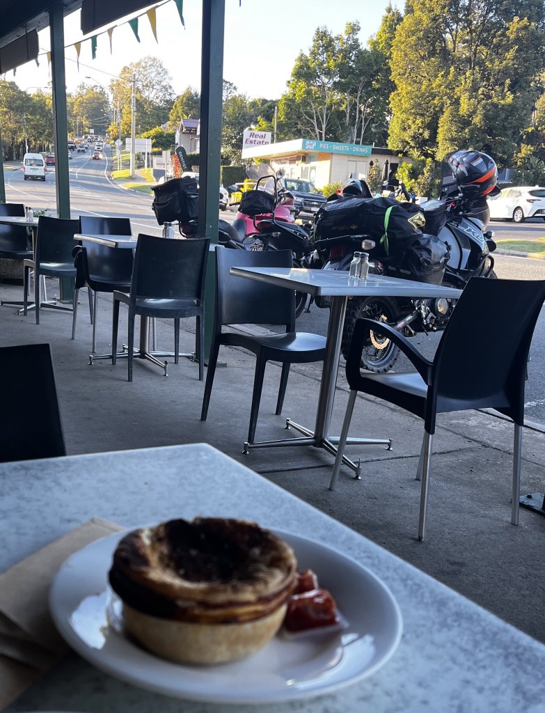
Breakfast of bikers 
Monument to our heros 
Famous biker cafe on a busy day 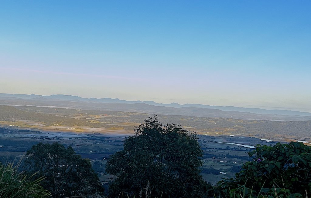
Looking out of the Lockyer Valley at Mount Tamborine, early morning, when riding the back road to Gympie.
Accurate Navigation
I don’t know what it is about me and navigating through the Lockyer Valley. I’ve ridden through about five times over the past couple of years and I still seem to get lost. Even with the GPS, I still seem to take the longest and most indirect way to my destination. But after a couple of hours, I had managed to find the Wivenhoe Dam. I’m starting to feel a little bit weary and as always I was on the lookout for a place to stop and have a coffee. I’m also on the lookout for possible future wild camping sites.
There are two roads around the Wivenhoe Dam, the left road goes to Esk a pretty little town in the Esk Valley with a great bakery. The road to the right takes you around the Somerset Dam Road. Having travelled through Esk already on this adventure, I was interested in trying the more direct route to Kilkoy. This road also has the turn-off to Mount Glorious.
A place to camp
The road to the right is on the eastern side of Wivenhoe Dam, it is some of the most enjoyable riding so far. It’s hard not to marvel at the beauty of the area, with sweeping corners, climbing twisty roads and stunning vistas of the crystal blue waters of the dam. Riding down into a small valley, I notice a rest area in a bright green patch of manicured green grass. It’s a perfect place to stop and make a coffee.

Emu takes a break 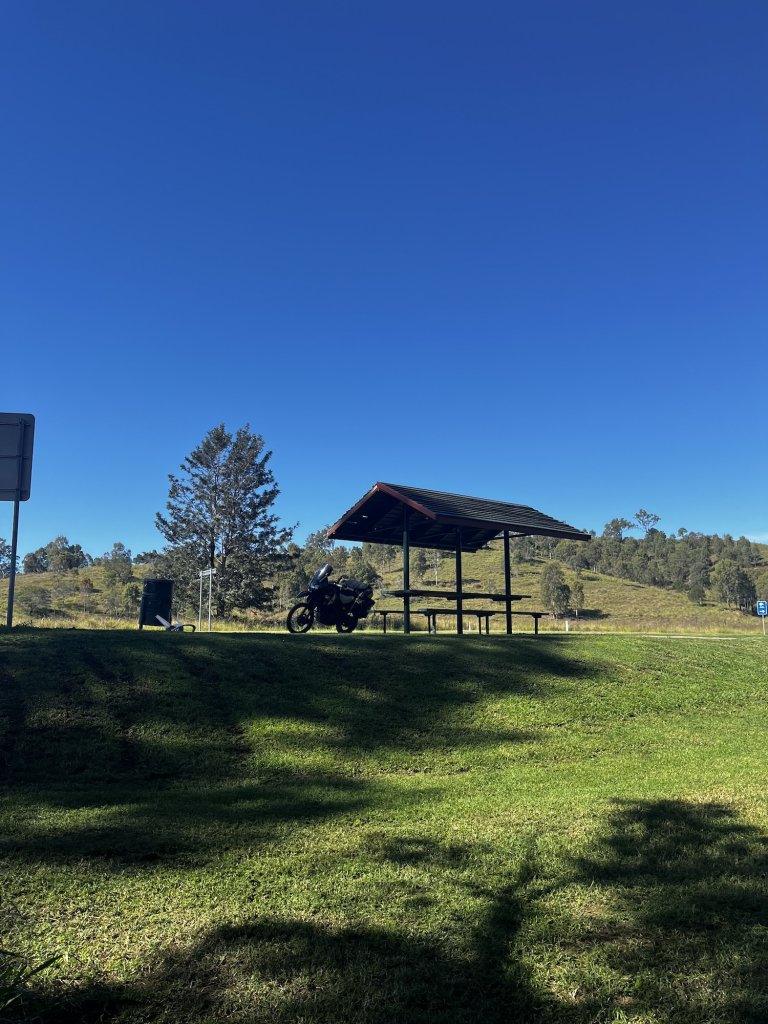
Somerset Dam Rest Area 
Stunning Creek, Crystal Clean Water
Moving on
I really want to stay at this rest area, there was a beautiful crystal clear stream running past and plenty of areas hidden from the road to have a secure night’s sleep. There was even a small council approved fire pit. But, my goal is to ride the back road to Gympie, and get to Gin Gin for the night. I knew if I didn’t continue, I would just be adding days to my journey. I had only planned to be away for two weeks. It was time to get home.
The road levels out as I get closer to the bridge that separates the Somerset Dam from the Wivenhoe Dam. On my rights is the mountain road that has caused the death of so many young motorcycle riders in Queensland, tyre marks from motorcyclists doing donuts before time trialling up the road, should I say racetrack through the D’aguilar national park to the Mount Glorious Café.
It’s real Café Racing, and of the 59 people killed on this road between 2018 and 2023,54 were bikers, it’s a death trap, not a racecourse. Having ridden this road a couple of times in the past couple of years, it’s a wonderful biker road if ridden sensibly. It winds up through forests, on the western side is typical Australian eucalyptus forests, while on the eastern side traces of rainforest. But, it’s a winding climbing dropping sort of road with blind corners, tight hair pins, moisture and wet patches and reverse camber on some of those blind corners.
The Roads a trap for young players
For the experienced rider it would be difficult to ride this road fast and safely, but for the inexperienced it’s a death trap. As a parent of a young rider, I can understand how this statistic happens, but no parent should bury their child. Rest in peace, young racers. I’ve added some photos from a previous adventure in this area, where I was acting as a Café Racer, see my story Café Racing-Queensland Style,

Mount Glorious Cafe 
Steep Up hill Corners-Photo from previous trip 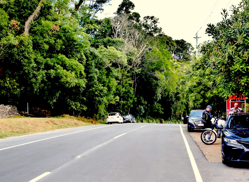
Looking down the racetrack, sorry road to the Somerset Dam Road 
Café Racer about to tackle the western side of the Mount Glorious Road – Somerset Dam Road looking South towards the Somerset Road Rest Area – Just over that hill.
Sunshine Coast Hinterland
The road takes me to Kilcoy where I join the D’aguilar Highway and head east to Woodford. Woodford is a great little town, best known for its annual Folk Festival, where thousands of hippies come each year to chill, sell crafts and dance like POGO sticks. Usually, it’s raining and muddy, but hippies seem to love that sort of thing. Just before I get to Woodford, I turn North again and head towards Peachester and the mountain top arts and crafts markets of Maleny. The last of the free rest areas on the Sunshine Coast is about 100 metres from the turn-off. I’ve started noticing more and more of what appears to be long term residents at free camping spots.

Semi-permanent camping at the Woodford Rest Area 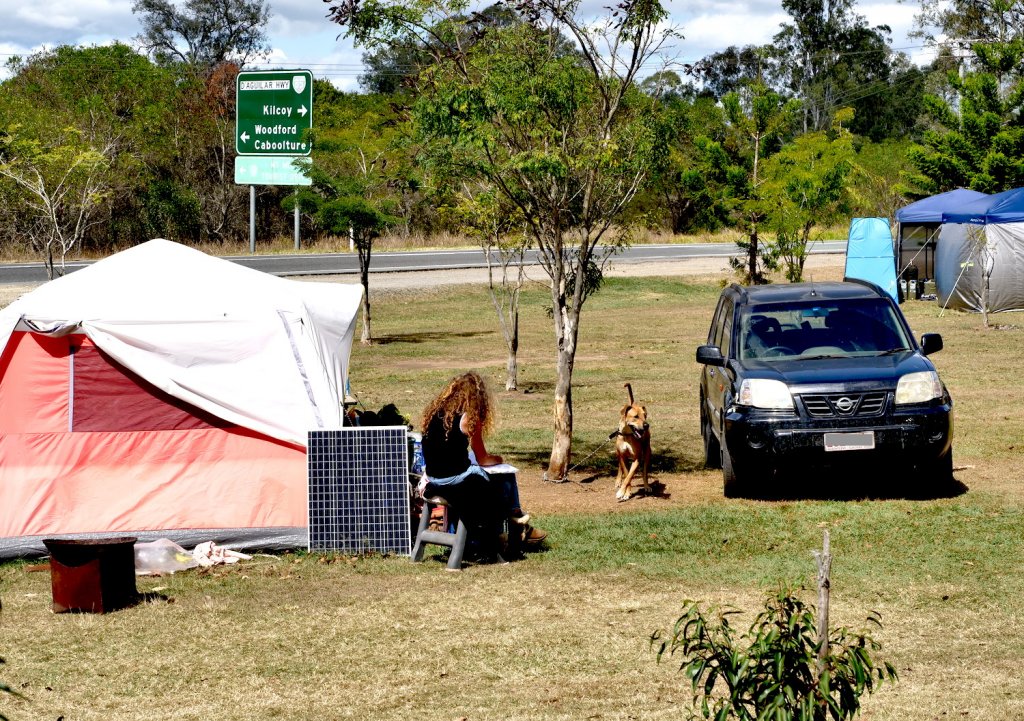
There’s plenty of room for camping and clean toilet block – Woodford Rest Area.
Riding up the range to Maleny
I follow this rural road as it winds through cattle properties and over small jump ups. The occasional caravan blocks the road for a short period of time, I take some risks riding past as I am all too aware of the coming twisty range climb I’m about to encounter, and I don’t want to burn out my clutch trying to maintain balance behind vehicles towing caravans up steep windy hills.
Having successfully passed five caravans, I’m now free to enjoy the up hill climbs and twisty roads at my leisure, knowing that any other vehicle is now sitting in behind a wall of caravans slowly making their way up the range like an army of caterpillars. I actually had to google that term. It sounds a bit like a joke, “What do you call a group of caterpillars?” – ” A Grey Nomad Army??
Riding the back road to Gympie through a rural valley
The road from the Maleny turn-off to Keniworth runs down into the valley between the Maleny National Park on the right and the Imbil State Forest to the left. It’s a magnificent ride through a crystal clear rural valley, there are small communities dotted all along the road. The road is well maintained tar with plenty of grip and smooth corners. This is biker paradise and I have the road all to myself. I don’t know what I was expecting, but riding the back road to Gympie is definitely on my travel itinerary the next time I come down this way. In fact, it might even be my chosen route from now on.

Keniworth is a beautiful small town, with café’s, traditional pubs and other small rural shops. There’s a show ground as you enter the town, and it looks like tents are welcome. I was seriously considering stopping for the night and grabbing a counter meal at the pub, but unfortunately I was running out of time.
Navigating the road less travelled
I have to stop and check my maps and GPS, I would hate to go the wrong way for a couple hours and have to find my way back to this point. I’ve recently come across a guide to the region created by a business called “Throw Your Leg Over”.
The company run motorcycle tours and have created some detailed guides for traversing the region. If you’re heading into the hinterland around the Gold and Sunshine Coasts this would be an ideal companion to load into your GPS. Unfortuantely. I’m not so technology literate or forward thinking. Check out the link below:

The cost of rental housing is showing on the streets
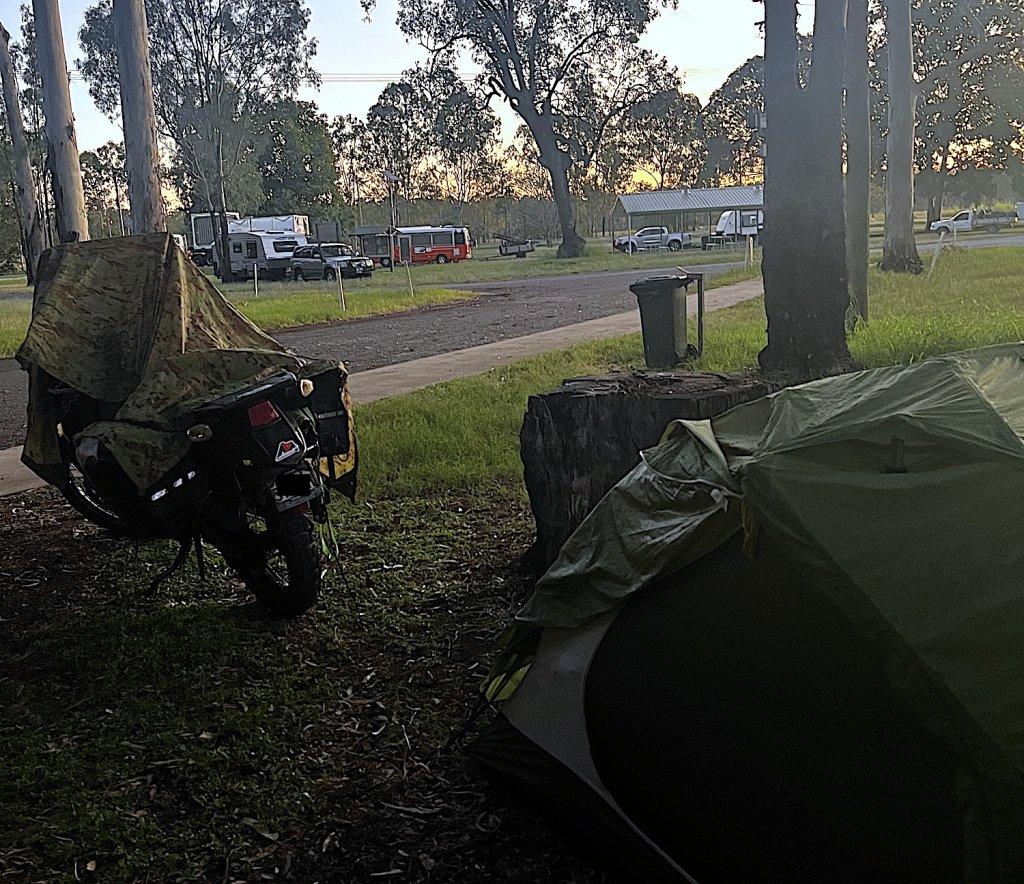
The road flattens out after Keniworth and continues through rural property until I get to Gympie. It was getting late in the afternoon, and I started to become concerned about Kangaroos and nighttime traffic. I knew of a rest area just north of the Gympie township, but when I get there I find it’s full of residents, people who were living there semi-permanently. No doubt the housing crisis and the excessive rental costs pushing the poorer people in our community into living off the land. These are not like the swaggies of old who chose the life of a traveller, these are people being pushed to the fringes. I’m starting to see this more and more as I travel.
A couple of years ago, it was people like me and grey nomads making up the majority of rest area campers. I can’t help thinking WTF, we are one of the richest nations in the world, and we have people that can’t afford rent. There’s a real problem in our society and it’s just getting worse. There was no room for a tent and the smell of an under maintained toilet block and rubbish bins that hadn’t been emptied in a while hit me as I ride in, it was not a pleasant place and I couldn’t wait to get back on the road.
The final leg
It was now 4.30 pm, I was tied from riding all day, but I felt I needed to continue, hopefully only one more hour to my destination. Riding the back road to Gympie, was a journey I have wanted to do for some time and I felt a quiet satisfaction in having achieved it. I stopped briefly in Childers for a bite to eat before wearily getting back on Emu for the last 30 minutes. As the sun slowly disappeared from view and the dark inky blue sky of night pushed the orange sunset out of the way, I noted the caravans and camper homes lined up at the rest area, a stark contrast between those in Gympie. I put up my tent, got out my camping gear and went off to sleep, reflecting on what an amazing ride I have just had.
2 Responses
A great read gazza especially the insight into the rental crisis affecting people is a real eye opener in the lucky country
I am up to chapter 57 on my book so hopefully I can finish it before and of 2025 and maybe we can do a launch together cheers dave
Thanks, Dave. The social issues of homelessness become highly visible when you travel around the countryside.