Kayak Ross River
OMG what a shitty place to stop for the night, is there no chance of getting to Cairns? While I wasn’t around back in 1860 to hear this comment, I’m pretty sure it would have been spoken by at least a few sailors as they mored their sailing vessels in what was to be named the Ross River, just North of a newly created rock wall. Let’s face it……its hot, not just hot but bloody hot and humid. There’s no air conditioning, not even a tantalising sea breeze, the banks are mud, deep smelly bug infested mud and everywhere you look there are little beady eyes of large salt water crocodiles surveying your every move working out how they can make you their next tantalising meal.
The sand flies are horrendous, the march flies actually take large bites out of your skin and oh yes, have I mentioned the crocodiles are just waiting for you to slip on the side of the boat or for you to stand at the water’s edge just close enough. That’s if you don’t get stung by those infernal, invisible, deadly killer jelly fish.
But don’t take my word for how horrendous it must have been, these are the worlds from the man for whom the town was named and who supplied the “Slave” sorry indentured labour to build the rock walls that became the Port of Townsville: “a most isolated place” and ” I never felt so unhappy from home in my life what from bites and blight I have been confined to the house since my arrival here”
While many of the dwellings in the town now have airconditioners, and fresh water, much of that old city can still be envisioned by the charming relics that still remain along the river. If you close your eyes in the middle of summer you can probably picture those sailors of yesterday.. But don’t do it close the the river edge.
Magnetic Island

A view of Magnetic Island from Mount Stuart. Castle Hill and Townsville in the foreground.

If you’ve been to Townsville in the Tropical North of Queensland Australia, it’s likely you have seen or been on the Ross River. It meanders from the Ross Dam about 30 kilometres from the city’s CBD to the sea at the Townsville Port.
This river is definitely the life blood of Townsville. From the early 1860’s when it was a safe anchorage for ships going between Adelaide and Darwin and a place to set in when the weather turned cyclonic, as it often does in the “Wet Season”. It was originally settled as an access point for miners, graziers and those seeking their fortune from tin, silver or gold across the range. Today, the Port of Townsville is a gateway for the export of copper, sugar, zinc, cattle and other agriculture products from all over North Queensland.
The town was established 1865 and grew rapidly. A shanty town was set up on both sides of the river, on one side known as Ross Island which sits in between Ross Creek and Ross River was more mud flat than arable land and prone to constant flooding during the wet, for a long time there were more Crocodiles than people. For any sane person that would have been a good reason not to live there?? It was also the main industrial sector of the town, while on the other side leading to higher ground around Castle Hill were the commerce and Government buildings. This town became known as Townsville after the infamous Robert Towns even though Towns seemingly hated the place and was of disputable ethics.
Interesting what being chairman of the Bank of New South Wales and a rich financier can get you.
Now let’s face it, if there wasn’t gold in them there hill why the f&#k would you leave a place with green grass and rolling hills to travel to the hottest, fly ridden, and desolate place in the world….just saying. However, there is gold in them there hills along with led, tin, silver, and copper. There was also seemingly endless land for grazing cattle. Had it not been for the discovery of these precious metals the hills around Charters Towers and north to Chilligoe it may not have become the thriving capital of North Queensland, that it did. That honour was destined to go to Bowen about 230 kilometres South East.
Bowen has the only deep water port from Brisbane to the Cape and one of the only places on the coast North of Brisbane to be able to provide safe anchor for large ships. Bowen also became one of the major cattle and sheep export ports in North Queensland. If you go to Bowen you will see the  streets were deliberately made wide enough for a major trading town.
Here in lies the real reason for the centralisation of Townsville as the capital of north Queensland, money and politics, but mostly money. The vision for the Port of Townsville was really driven by one man John Melton Black. It was Black that sent his station manager to find a suitable place to build a port, in order to supply the grazing land with a supply port  and a way to move cattle quickly to southern markets.
He recognised the potential and was able to establish a partnership with a trader and financier Mr Robert Towns. Black and Towns both astute business people conceived a plan to use indentured (Slave) labour, brought to Australia on Towns’s ships from the South Pacific and associated pacific islands to build a break wall making the Ross River a secure port. So lucrative was the “Indentured labour” that more (Slaves) were brought to North Queensland through the port of Townsville to supply the growing sugar plantations. Robert Towns himself never lived in the North of Queensland and only visited once. After making his famous speech (see above) he departed back to Sydney never to return.
The advent of the gold and mineral rushes that took place in the late 1860’s meant settlers and miners and fortune seekers needed easy access over the range and Bowen was just a little too far away to make it possible. A route was found over the Harvey Range and then later over what was to be called the Mingela Range Crossing to Charters Towers which is known today as Ravenwood Junction although the town of Mingela still exists and is the exit point to Ravenswood (see my story “Is Ravenswood the next Gold Rush destination?”).
The Ross River was a seasonal supply of water, but with a growing town the bores that supplied the town with fresh water could not cope so the a series of weirs were constructed. The first of these was Gleeson’s Weir named after the pastoral property from which it was developed. Initially these weirs were just corrugated iron bashed into the sand until it hit the clay base. Later these flood affected structures were replaced by concrete walls. The Weirs replace the bore pumps scattered along the river. One of these pumping stations is still visible as an ageing and unappreciated relic of days gone by.
Old Pump

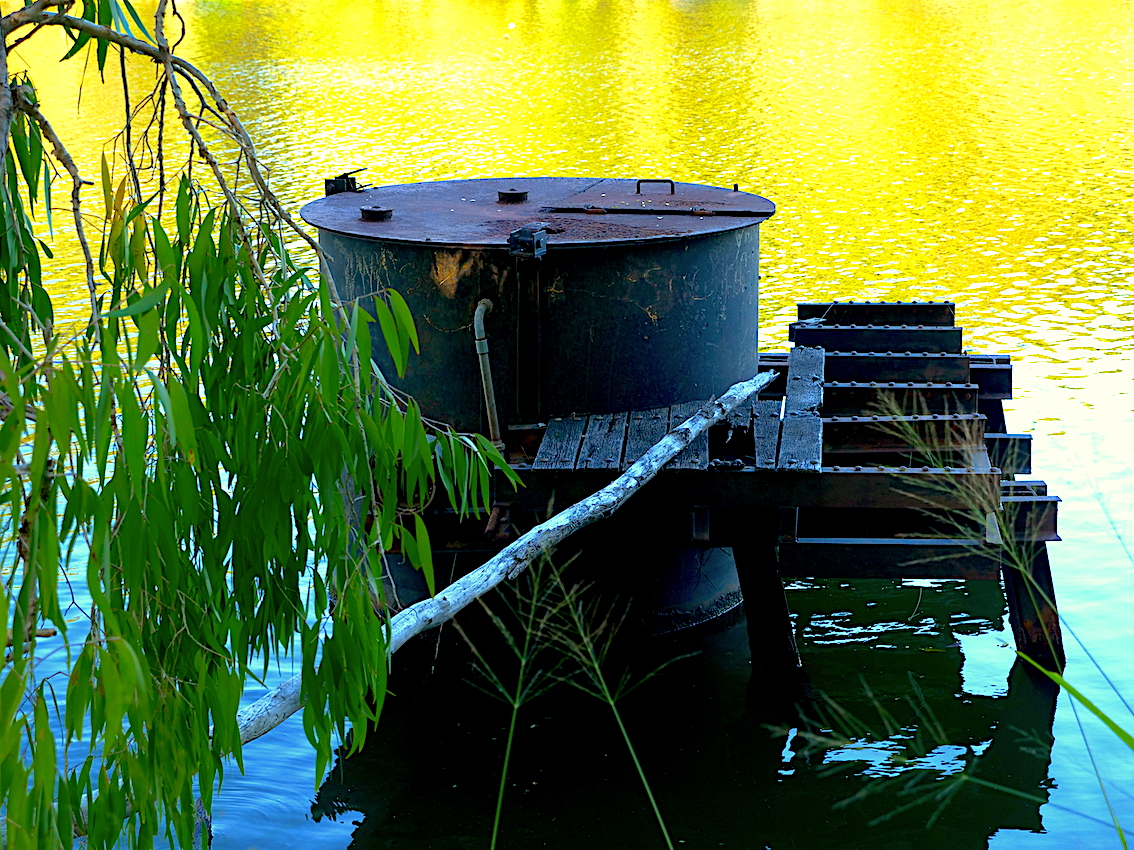
This old pump used to provide water to surrounding cattle properties. A relic of the past when getting water was critical to the growing towns productivity.

As the town kept growing the need for water became more and more problematic so a second weir was built (Alpin’s Weir – this one separates the fresh from the salt water on the Ross River) and then a third weir (Black’s School Weir) was built. Finally, after fifty years of complaining about not having water the council decided to build the Ross Dam. This seems to be the way things are done in Townsville, wait until you run out of water, then build a dam or a pipe line, some things never change!!
Blacks Weir

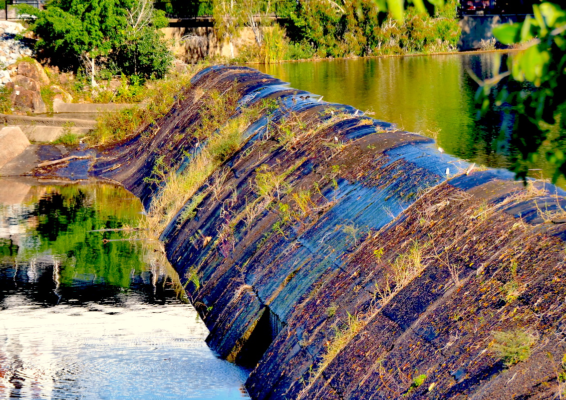
Water gently flowing over Blacks Weir.

With the construction of the Ross Dam, these weirs are no longer used for water supply and today they provide a fresh water play ground for Townsville residents. If any environmentalist wants to say that controlling the water flow by building dams and weirs is damaging for the environment they want to take a good look at the ecology of the Ross River.

Without doubt one of the most visually spectacular areas of Townsville is the Riverway pathways and riding trail. The Council created a bike and walking pathway from the Bowen Road Bridge through the the Riverway Parkland, from which it turns into a walking track West of the Bruce Highway Bridge which also consists of an underslung pedestrian bridge that completes the Riverway’s Pathway loop.
This is an approximately 25 kilometres bike track along the river. It starts on the down stream saltwater part of the Ross River and passes all three weirs. If you walk it briskly it will take a good three and a half hours but on a bike you can do it in approximately one to one and a half hours. There is an abundance of animal life and human water sport activity on the Ross River.
Walking track Upper Ross River

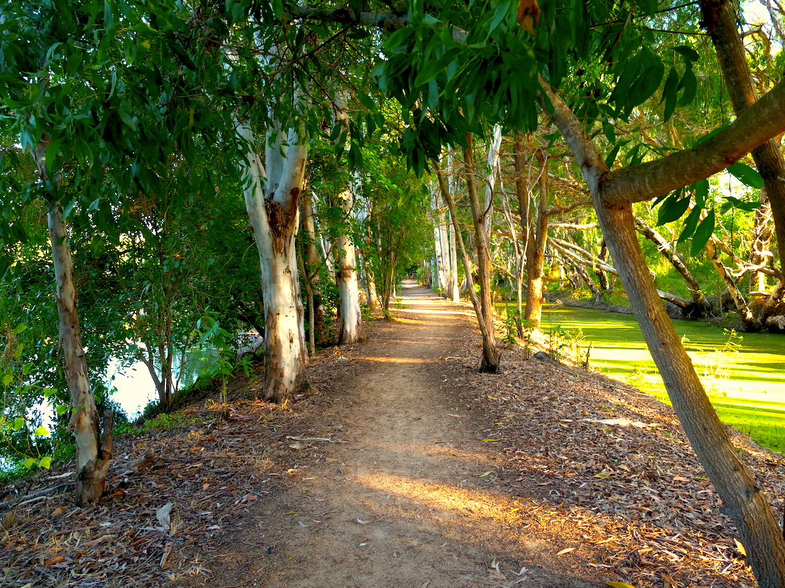
The bike path continues past the Hume Highway over pass up to the Ross Dam

The water way continues past Black’s Weir into the Upper Ross Catchment before ending at the Ross Dam wall.The Upper Ross catchment is a playground for water sports including water skiing, kayaking and fishing. Remnants of the past can still be seen along the Upper Ross such as the Apex Park Pump which supplied the outer communities with water until it was made redundanct by Black’s Weir.

So let’s face facts, before European settlement the Ross River (although I’m not sure of its original name) was a seasonal water course, but once the weirs were established it became a very important asset that enabled Townsville to grow.

Kayakers Ross River

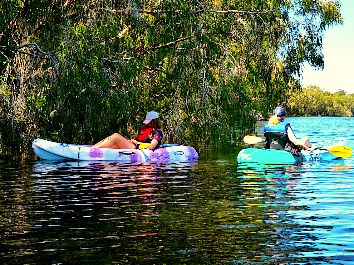
Kayakers enjoying the Upper Ross River

Today, the Ross River is an amazing natural play ground and community asset. Well worth visiting if you are in North Queensland. Personally, you can walk the strand, have a beer at the many traditional pubs in town, climb Castle Hill, but the best part of Townsville is definitely the fresh water parts of the Ross River. Important note: If you want to get that feeling the original sailor got, just go east of the Bowen Bridge, but watch out for crocodiles and deadly jelly fish.
Digital Swaggie:)
#

One response

Leave a Reply

Your email address will not be published. Required fields are marked *